Description
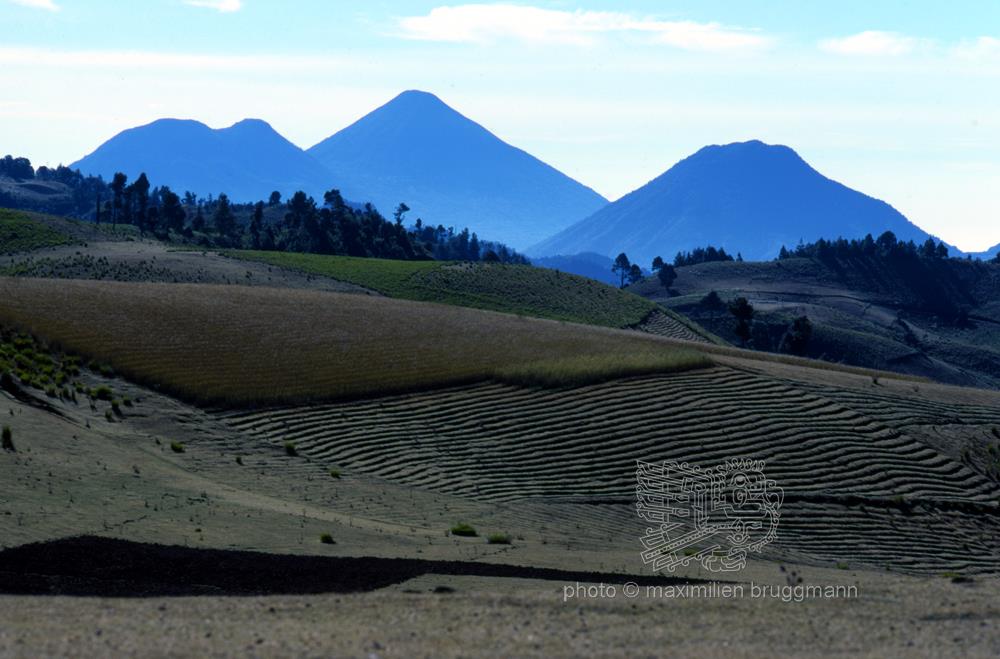
Photo taken from the Panamerican Highway which, coming from the Mexican border and crossing the mountainous area, leads to the capital of Guatemala. The well-designed and well-maintained crop fields on the often steep slopes of the volcanoes stretch as far as the eye can see and give the landscape its characteristic appearance. The volcanic ash regularly enriches the land, enabling Indian farmers to successfully grow maize, cereals and a multitude of vegetables, which form the basis of the indigenous population's daily diet. Indeed, the food of the indigenous people is primarily vegetarian. Meat appears on the table on feast days or on the occasion of exceptional circumstances such as a baptism, a wedding or the appointment of a new community leader. The relative altitude of the land, the mild climate and the abundance of rainfall favour the development of agriculture. - 1977
Description
Photo taken from the Panamerican Highway which, coming from the Mexican border and crossing the mountainous area, leads to the capital of Guatemala. The well-designed and well-maintained crop fields on the often steep slopes of the volcanoes stretch as far as the eye can see and give the landscape its characteristic appearance. The volcanic ash regularly enriches the land, enabling Indian farmers to successfully grow maize, cereals and a multitude of vegetables, which form the basis of the indigenous population's daily diet. Indeed, the food of the indigenous people is primarily vegetarian. Meat appears on the table on feast days or on the occasion of exceptional circumstances such as a baptism, a wedding or the appointment of a new community leader. The relative altitude of the land, the mild climate and the abundance of rainfall favour the development of agriculture. - 1977