Description
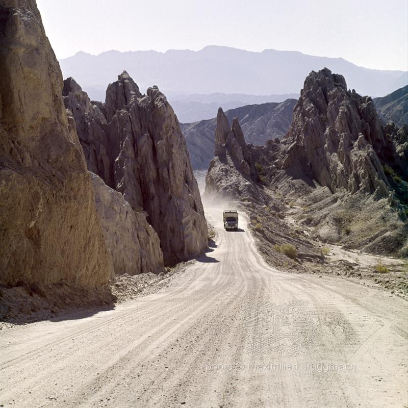
Argentina has a road network which in many provinces is in good condition. It allows for relatively fast travel, which is particularly appreciated as the distances between cities are enormous. Some roads extend as far as the southern regions. Others cross the pampas. Still others run along the Andes or set out to conquer the formidable mountain range. One of the latter links Buenos Aires to Santiago de Chile, via passes at an altitude of over 4,000 metres. Very often these roads are not asphalted. Terrible natural obstacles hamper their maintenance. The National Road No. 40 follows the eastern flank of the Andes mountain range. It is the busiest road between Río Gallegos (province of Santa Cruz) and La Quiaca (province of Jujuy). It covers a distance of almost 4,500 kilometres. Avalanches and landslides interrupt this road. The landscape in the Calchaquies valley is desert-like. The rocks are reminiscent of backwash, hence the name of Corte el Ventisquero, given to this area of Salta. - 1973